The north Eastern Cape interior wedged under the Orange Free State and Lesotho, seems so peaceful nowadays. Tranquil landscapes and farmlands, and small-blink-and-you’ll-miss-them towns, makes one forget that the place has a history as one of the frontiers of the old Cape Colony. Towns bear names which often relate back to European origins: For example, Ugie after the Ugie River in Scotland; Molteno after the first Cape Prime Minister, John Molteno whose ancestors actually came from Molteno in Italy; Dordrecht after a town in South-West Netherlands.
I won’t go into a long history of the region, except to say that coal was first discovered in the Stormberg Mountains near Molteno, which led to the town being established. During the Second Anglo-Boer War “Molteno was used as a mustering point for troops prior to the famous Battle of Stormberg, as it was the closest railway station” (Wikipedia). Another claim to fame, is that it is the coldest town in South Africa (Really? I had thought that Sutherland in the Karoo would be a contender). So with that chilly and snowy winter weather it is no surprise that Molteno is also close to Tiffindel, the only ski-resort in South Africa. Although the resort is now under new management, and is currently not operational. Molteno is also the home of Ouma Rusks. “Ouma” is the Afrikaans word for “grandmother”; and rusks are a type of sweet bread first baked, then cut (or broken) into rectangular shapes and dried in the oven. You eat them by dipping them in your coffee or tea before eating them. If you find my description puzzling, go to this site for a nice photo and recipe.
The other towns in the area – Ugie, Elliot, Indwe, Dordrecht, Steynsburg, Middelburg – support farming and forestry communities. Centred around a church (or several), they provide the infrastructure for the rural communities.
In Willie’s last post he described taking the “long and scenic” route to the town of Ugie. In other words: he got lost! On his way back, he stopped to take some photographs which will give you a good idea of the changing scenery during the drive. He passed through the area the day before the first heavy snowfalls of the year, which I wrote about in this post.
Most of the photographs here were taken between the towns of Ugie and Middelburg. [See map of route here]

Forestry guest-house between Ugie and Maclear. With a view and a nice fireplace to keep you warm on bitterly cold winter nights. ©WMB/notesfromafrica.wordpress.com

Forestry plantations near Ugie. The town of Ugie was established from a nearby mission station in 1863. Today, the area is predominantly a forestry one. ©WMB/notesfromafrica.wordpress.com

Tail-end of the Southern Drakensberg mountains. Although not very high here, the Drakensberg (from the Dutch Drakensbergen, “the Dragon Mountains”) is the highest mountain range in Southern Africa, rising to 3,482 metres (11,424 ft) in height. The mountains are capped by a layer of basalt approximately 1,400 meters thick, with sandstone lower down, resulting in a combination of steep-sided blocks and pinnacles. [Information from Wikipedia] ©WMB/notesfromafrica.wordpress.com

Landscape in Ugie area. ©WMB/notesfromafrica.wordpress.com

Between Ugie and Elliot. ©WMB/notesfromafrica.wordpress.com

Burned grassland. In this area, grasslands are often burned intentionally to stimulate the growth of new grass shoots. ©WMB/notesfromafrica.wordpress.com

Old stone farm building. ©WMB/notesfromafrica.wordpress.com

An abandoned farm house. The Poplar trees on the right, are a very common sight near farm-houses in South Africa. ©WMB/notesfromafrica.wordpress.com

In a street in Molteno. Small businesses struggle to survive in these small towns – hence the sign. ©WMB/notesfromafrica.wordpress.com

The ubiquitous church – every little town has at least one! This is the Molteno NG Church. ©WMB/notesfromafrica.wordpress.com

An old house in Steynsburg. These properties are quite cheap to buy and are marketed as a place to retire, or for folks wanting to get out of the city. Often quite a few writers, photographers and other artists can be found in these little towns. ©WMB/notesfromafrica.wordpress.com

The view towards Middelburg. ©WMB/notesfromafrica.wordpress.com

A farm homestead in Middelburg district. ©WMB/notesfromafrica.wordpress.com

A typical old farm dam with windmill water pump. With an abundance of sunshine in the drier areas of South Africa, these windmill water pumps are being replaced by pumps powered with solar energy. ©WMB/notesfromafrica.wordpress.com

As the journey continued, storms clouds started building up ahead of the first major snowfall of the winter the next day. See Karoo Winter Wonderland post. ©WMB/notesfromafrica.wordpress.com

Curious horses coming to check out the photographer. ©WMB/notesfromafrica.wordpress.com

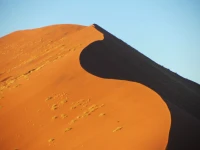
Typical Central Karoo landscape, with Skoorsteenberg (English translation: “Chimney Mountain”) in the background. ©WMB/notesfromafrica.wordpress.com

Closer view of Skoorsteenberg. ©WMB/notesfromafrica.wordpress.com

Farm building ruins close to Uniondale (in the Little Karoo, Western Cape) with the typical aloe plants of the area. ©WMB/notesfromafrica.wordpress.com


Gosh, these are gorgeous images, Lisa. Hope you and Willie have had a lovely weekend.
Hugs,
Kathy
Thanks Kathy! Willie didn’t have much time to stop and take photos, so he I think he did pretty well.
Thanks so much for the beautiful photos, I had no idea that there is topography as such in Africa, it reminds me much of my native California as it was a hundred years ago.
Thanks Gian! Southern Africa has very varied landscapes – forests to deserts; mountains to flatlands. This particular area is very rural and hasn’t changed much over the last 100 years either!
Great photos and excellent post. I love Ouma rusks, I will check out your recipe and give it a go!
Thanks! Does your knowledge of bergwinds and Ouma rusks mean you are an ex-South African?! The recipe isn’t mine, but it was the one that had a “Ouma Rusks” style photo. I haven’t tried it yet.
The landscape always surprises me. Got in trouble with a South African on vacation. I confused the accent with an Australian one- big oops!
A lot of people comment on the how varied the South African landscape is. HUGE mistake to confuse the South African and Australian accents! The South African accent is much more refined! 😉 [Just kidding you Australians out there.]