The Tankwa Karoo is an enormous flat pan sandwiched between the rocky Cederberg range to the west and the Roggeveldberg to the east and stretching from Ceres in the south to Calvinia in the north.
It is the driest land in all of South Africa, with summer temperatures regularly soaring into the 40’s. But the winters are quite comfortable, and occasionally can bring forth a short but beautiful display of spring flowers.
A guest post by Karl-Heinz for Notes from Africa
The previous post in this series is A cloudy day.
Thursday, 30 August saw us on our way early, and we left Kamieskroon for the Tankwa Karoo National Park, south of the town Calvinia. We travelled back to Garries on the N7, and just south of Garries turned right. Following the less travelled roads via Loeriesfontein and Calvinia, and entering the Tankwa Karoo National Park from the western side.
As luminous clouds of dust swirl through the ancient landscape, a tortoise patiently ambles around in search of some succulent morsel, a lizard basks in the sun while gemsbok and red hartebeest share the arid plains with mongoose, orb-web spiders, skinks and leggy toktokkies…
Tankwa Karoo National Park is situated on the southern boundary of the Northern Cape with the Roggeveld Escarpment in the East, Cederberg in the West, and Klein Roggeveld Mountains in the South.
Just a four-hour drive from Cape Town brings you to this truly unique national park. Situated within the Succulent Karoo Biome, the area is renowned for its rare and endemic plant species, rich bird life, and landscapes that will take your breath away – from the sheer cliffs of the Roggeveld Escarpment to the moonscapes of the Tankwa Desert.
While Tankwa Karoo National Park is still in a developmental and land consolidation phase, expanding from the original 26,000 hectares in 1986 to nearly 143,600 ha by late 2010, it is the ideal destination for those seeking the brightest stars in Africa, a once in a lifetime glimpse of a rare endemic bird or perhaps nothing more than a silence that reaches deep into the soul . . .
From: SANParks – Tankwa Karoo National Park
Here we would camp in our tent for two days before heading home on Saturday, 1 September.
We arrived at ± 15h00 after a long and wonderful sunny day, travelling all the back roads, stopping regularly to take pictures of trees, flowers etc.

The Karoo is goat – and especially sheep – farming country. ©Karl-Heinz Niemand

The long and winding road. ©Karl-Heinz Niemand

No shortage of rocks! Trees grow in between huge boulders. ©Karl-Heinz Niemand

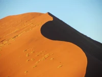
©Karl-Heinz Niemand

Although there were less flowers in this very arid region, some Spring flowers still added colour to the drab surroundings. ©Karl-Heinz Niemand

©Karl-Heinz Niemand

Quiver trees (Kokerbome). For more photos and information about Quiver trees see the post Quiver Tree Forest near Nieuwoudtville. ©Karl-Heinz Niemand

Late afternoon glow over the Karoo. You can see the moon rising just above the ridge. ©Karl-Heinz Niemand
Friday, 31 August. Bad weather for the day, but nothing stops us and we took off exploring the park and went up the “Gannaga Pass” from ± 550 metres above sea-level on the plains to the highest point of the pass at 1,267 metres. Returning from the pass, we travelled a short section of 4×4 track and arrived at a water point. In very cold windy weather we stopped, made coffee and had lunch. The rest of the afternoon I spent walking the hills around our camp-site, looking more closely at the plants growing in the area. That night it rained.

Ominous storm clouds ahead of the Gannaga Pass trip. ©Karl-Heinz Niemand

A deserted stone cottage. ©Karl-Heinz Niemand

Gannaga Pass. ©Karl-Heinz Niemand

One of the graves which dates back to the 1838 Great Trek. People buried here were on their way to join other Trek groups. ©Karl-Heinz Niemand

©Karl-Heinz Niemand

©Karl-Heinz Niemand

©Karl-Heinz Niemand

©Karl-Heinz Niemand

©Karl-Heinz Niemand

©Karl-Heinz Niemand

©Karl-Heinz Niemand

©Karl-Heinz Niemand

©Karl-Heinz Niemand

©Karl-Heinz Niemand

The last night of camping in the Tankwa Karoo. ©Karl-Heinz Niemand
Our last day arrived with the sun shining and we headed home via back roads again and hit the tar road somewhere between Sutherland and Matjiesfontein. We spent some time in the settlement of Matjiesfontein and had a light lunch. I went back down memory lane at the railway station to when we were kids going to Walvisbay by train during school holidays. It took four days to travel from Cape Town to Walvis Bay. [A separate post on Matjiesfontein is to follow. Lisa.]
From Matjiesfontein we travelled a short section on the N1 to Laingsburg, and from there towards Ladismith, and through the Seweweekspoort back to Oudtshoorn.
We started our trip five days ago with snow on the mountain peaks just before Ladismith, and we ended our trip at the back at the same peaks, still with some snow.
We travelled 2,332 kilometres of which two-thirds were on dirt roads or tracks. We had a much-needed break, which was wonderful but too short.

©Karl-Heinz Niemand

©Karl-Heinz Niemand

©Karl-Heinz Niemand

©Karl-Heinz Niemand

Slabs of sandstone rock at the Tankwa River. [Thanks for the rock identification Lu @ The Unwitting Traveller] ©Sonette Niemand

©Karl-Heinz Niemand

©Karl-Heinz Niemand

©Karl-Heinz Niemand
Other posts in the Namaqualand and Tankwa Karoo series include:
- The Clanwilliam Flower Show
- The Namaqualand National Park
- A cloudy day
- Namaqua Rock Fig
- Tankwa Karoo National Park (this post)
Thank you to Sonette and Karl-Heinz for sharing their trip and beautiful photographs with me!


A lovely series of photographs – they certainly help to portray the vast distances. I really must say that I absolutely enjoy SANParks descriptions – they are so wonderfully romantic. If I wasn’t already smitten with African nature – I would be after reading that!
Yes, those SANParks descriptions are great, aren’t they? Just want to make you pack up your gear and go there right now! There are some wonderful rocks in the Tankwa Karoo, so you should put it on your list to visit. 😉
Thanks again for identifying the rocks for me! The SANParks geology page was actually for the Karoo National Park (close to Beaufort West), but I assume the same type of geology applies to the Tankwa region. I was thinking that because there were big rectangular blocks of rock falling down, that it might be something more exotic than sandstone. I meant to put your link into my post . . . have done so now.
🙂
Thanx, that is so special. The Karoo is my special place and the Tankwa-Karoo is on my wishlist of places to see. Beautiful pictures.
Thanks Estie! Karl-Heinz and Sonette took some stunning photos. It was really difficult to choose which ones to feature in the post. I also find the Karoo totally fascinating. I described the vegetation as “drab” in the post, but it was meant in a “good way”! 😉 I love the muted colours there.
I have been scrolling back and forth, and shall be back when time is more kindly! Wonderful photos: such a present to have – am lining them up to send > number of lists. Unfortunately, jokes, politics and sex are oft more ‘funny’!! Am still madly comparing what you have pictured with what we have here at the same latitude in Australia. Fascinating!! OK: have just listed you on some of my resend posts – there have to be some like me on the receiving end!
Thanks Eha! I appreciate your support and you publicizing the post for me. Yes, one is bound to see similarities between the Australian and Southern African landscapes.
This looks like such a woderful place. I so hope I get there one day. Thanks for a glimpse into an amazing place.
It’s a very interesting place – almost like a moonscape in places.
Amazing place and wonderful photos.
Thanks for visiting my blog and for your kind comment! 🙂